
The historic little South Derbyshire market town of Melbourne, nestling comfortably in the historically rich and fertile countryside just to the north of the Leicestershire border, is the start and finishing point of this most delightful and interesting ten mile
circular Jaunt.
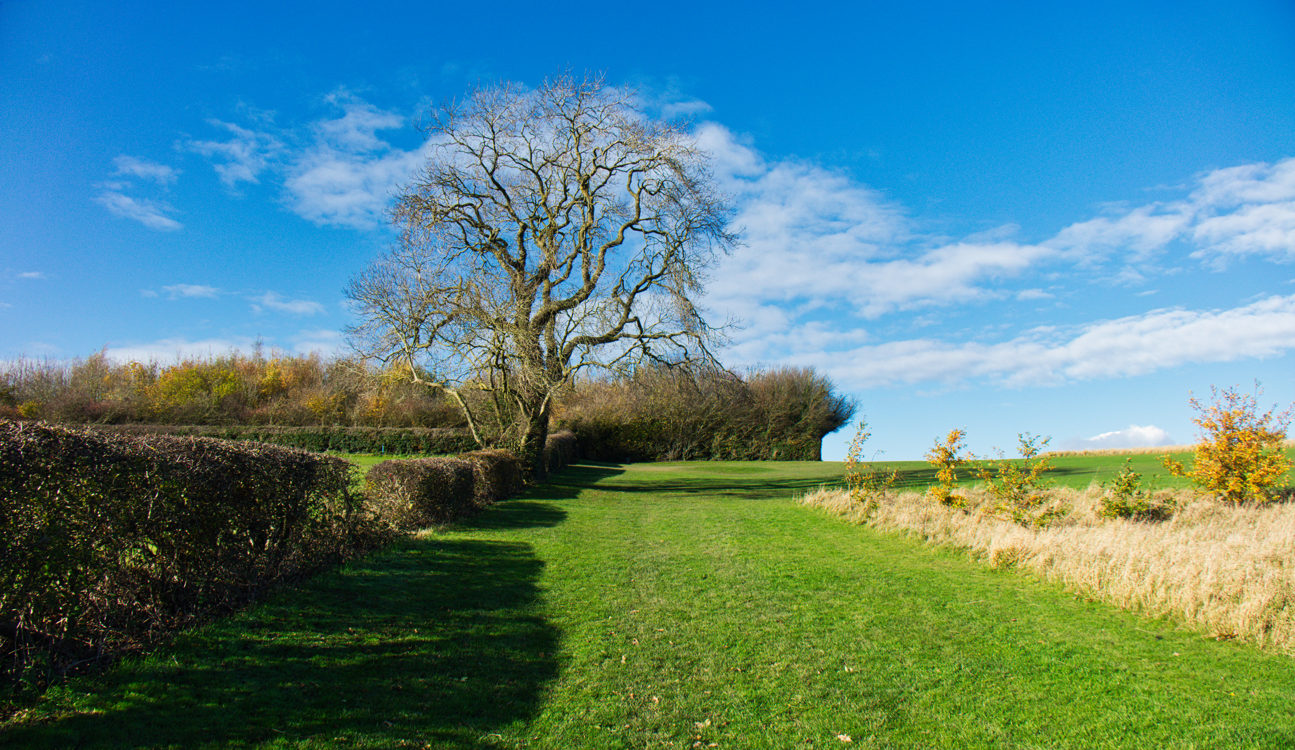
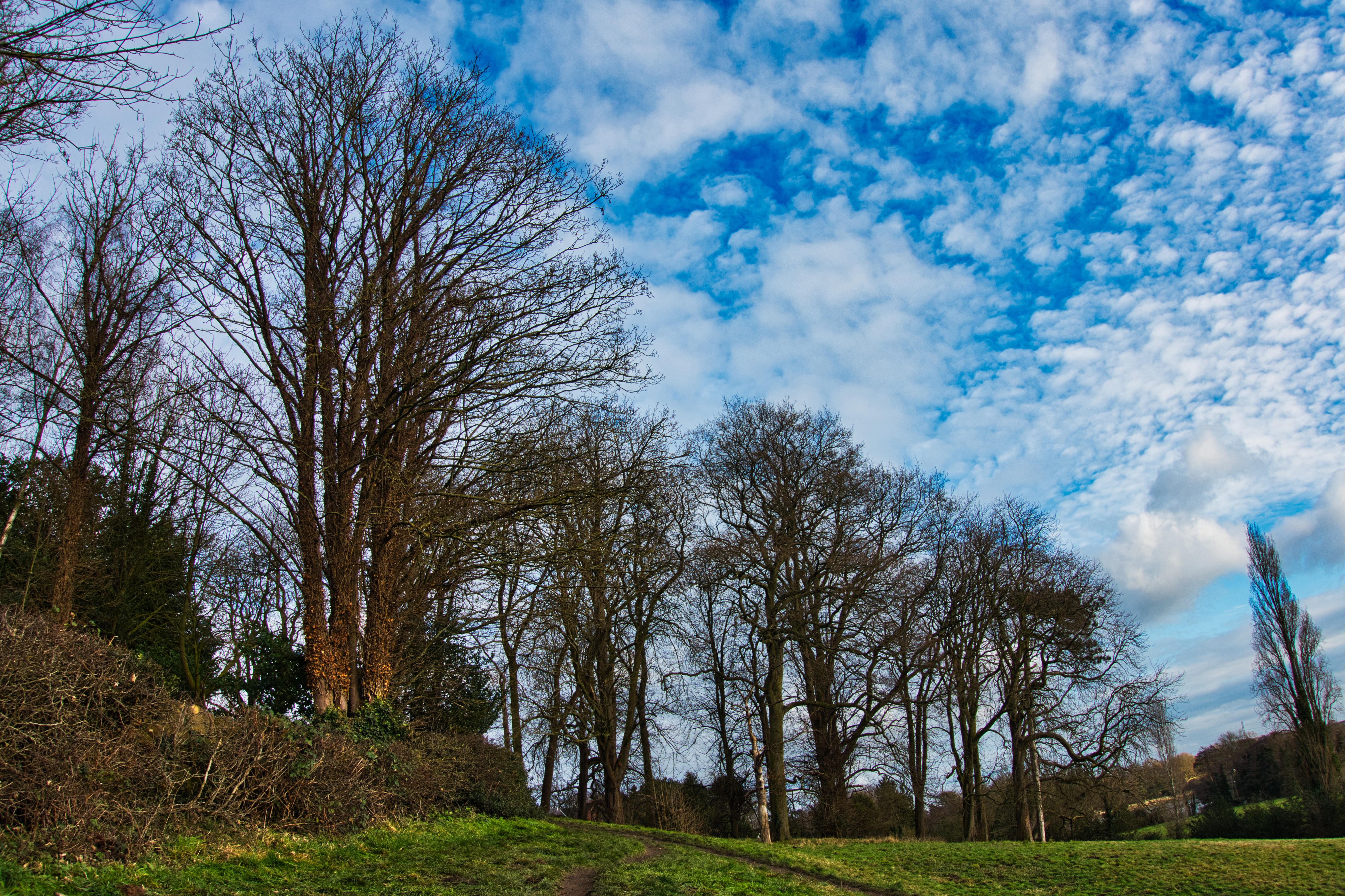
As in common with most of my walks, this absorbing little plod doesn’t always follow an obvious and logical line, {logic not being one of my stronger points} and this one is no exception. Twisting and turning, it gradually finds its way in a devious clockwise direction through the beautiful shallow green valleys and gentle time worn hills surrounding the Staunton Harold Reservoir While trying to seek out some of the more interesting and esoteric little corners to be found in this most beautiful part of the North Midlands.

Parking and Map.
Park adjacent to the fine Norman church of St Michael and St Mary near the centre of Melbourne. The parking here is quite limited so as an alternative you may have to resort to parking on
Blackwell Lane.
SK 389 250. OS Explorer Map 245.
The following abbreviations found within the text are, {Y’F’P’} = Yellow Finger Post, {R’F’M’} =Round Footpath Marker, {T’F’S’} = Tall Footpath Sign, {N’F’W’M’} = National Forest Way Marker}.
All the crops mentioned were present in the fields at the time of writing. Obviously as time goes by these may be rotated/replaced with a different crop.

The Walk
Leaving your car walk south to by-pass the church through a pair of impressive heavy wrought iron gates onto Pool Road. Follow the road down between the high sandstone walls towards
Melbourne Pool. On reaching the lake continue following the road as it curves to the left under a pair of magnificent old cedar trees that weeping, stand guard over the narrow southern entrance to
Melbourne Hall.

This lovely warm sandstone Georgian country house, {one time seat of the Victorian prime minister William Lamb, the second Viscount Melbourne}, is famous for its baroque style gardens. In particular the spectacular wrought iron arbour named the Bird Cage that stands close to the ornamental lake within the hall garden.

Robert Bakewell a local iron smith created this and other wrought ironwork around the hall’s gardens in 1706 before moving to set up a forge in Derby. From there he went on to fabricate the wonderful rood screen in Derby Cathedral, along with gates and fencing etc for many other local churches. Amongst these the splendid entrance gates into the Silk Mill {now an industrial museum}, standing on the banks of the river Derwent in the centre of the city.
This museum is well worth a visit, as are Melbourne Hall gardens; May June being the best time when the primulas are in bloom.
 Wander on alongside the pool, walking between the tall sandstone garden wall on your left and the roadside’s low stone retaining wall on your right. After admiring a section of Robert Bakewell’s wrought iron balustrade atop the the garden wall, keep on down the wide smooth metalled road noting the mad yew topiary in the hall garden, and enjoying great views over the lake to your right while being pestered by the
geese ducks and swans begging for bread.

After by-passing the charmingly situated Old Mill Cottage, leave the lake to keep following the road past Pool Cottage. Continue on through high sandstone walls before re-joining the lake at its north-eastern outlet. Following the low walls set above the impressive stone masonry surrounding the outflow, by-pass a five-bar gate and wooden wicket’ set on the end of the wall, {no parking sign on gate, to continue along the gravel oak -lined track curving slowly to the left until on the right you see a second wicket {T’F’S’}.

Take this gate to enter an arable field, follow a well trod path through the barley towards a wooden stile 15 meters left of a large hedgerow oak standing in the left-hand corner of the field. Enter into the following barley field to keep plodding along the track to a two step wooden stile set fifty meters to the left of its left-hand corner, {R’F’M’}. Cross over following a broad grass headland by the side of a lovely piece of mixed woodland named the
Quarry Wood.

Where the woodland ends continue along the headland/track and sticking to a low hedge walk on to the fields left-hand corner. Here, under a clump of sycamore you will find a short set of steps leading down to a wooden stile set under a large multi-stemmed
ash tree, {R’F’M’}.

Follow the path into a grass meadow, bear right then back left by an old ash stump in the fence line, {R’F’M’} attached to stump. Follow the fence line passing under a group of four oak trees to join on a bend, a stone drive leading up rightwards to a group of warm yellow sandstone buildings, {Common Farm}. Turn left following the drive, {south} for about 150 metres or so, walking under a mix of young and old, ash oak and lime trees lining the sides of the track, until on the left you see a gap in the barbed wire, {Y’F’M’s}

Pass through the gap to follow a well trodden path through the centre of the crop {slightly south of east}, towards Paddock Pool Wood. Continue following the track over a broad grass headland down to the remnants of a wooden stile on the edge of the wood, {R’F’M’s}.

Turn immediately left then back right, following the vague difficult to see path under a fine stand of tall straight stemmed oaks down to a railway sleeper bridge above a wide slow sluggish brook.
After crossing the bridge bear left, walking steadily up under more magnificent oak trees to a wooden stile and gap on the edge of the woodland. Pass through/over and out into a narrow arable field.

Cross the headland/farm track and by-passing a farm gate walk straight ahead {south of east} following the right-hand side of a low hedge. Continue plodding steeply on up the headland, by-passing a second gate into the corner of the field. Following the headland bear round to the right for fifteen metres to find a wooden stile/gap on the edge of Gorse Covert. Enter the woodland and bear right, before climbing steeply up under another stand of fine clean stemmed oaks to find a set of steps leading steeply up to a wooden two step stile set on top of the bank at the edge of the covert.

Scramble steeply up and over the stile into a large arable field. Head straight through the crop {east}, heading towards a wooden electricity pole and a pylon. As you crest the brow of the field, directly in front of you Breedon Hill comes into sight, with the square tower of the ancient Priory Church of St Mary and St Hardulph standing out on its summit.

Heading straight towards the hill, plod on down towards the densely wooded and overgrown hedge at the bottom of the field. {This hedge-line and its ditch follows the line of an old medieval Park Pale}. On reaching the hedge turn left {north east}, and follow the muddy headland into the corner of the field, {Y’F’P’}.

Pass through a wide gap and keep following the line of the park pale/headland along the bottom of the next arable field into its corner, {Y’F’P’}. Go through to continue along the headland/farm track between a stock fence on the left and a wide ditch on your right, until towards its end it curves sharply to the left before joining the metaled drive leading up to Park Farm, {T’F’S’ and Y’F’P’}.

Turn right on the bend to follow the narrow lane between hedgerows for about 100 metres or so until you see a {T’F’S’} pointing to the right, {at this point the Cross Britain Way crosses the lane}. Obeying the sign, turn right {South}, to pass through a wooden wicket set in the hedge-line taking you into a grass meadow, {Y’F’P’}. Walk straight over the meadow heading for a wooden wicket standing to the left of a line
of tall thin poplars.

Here you are entering the Breedon Priory golf course, that at the time of writing was looking very neglected, unused and overgrown with ominous signs of new building work away to the north ? {left} Maybe another casualty of the Covid 19 virus !

Keep following the line of poplars by-passing a wooden park bench on the left, as the hillside opens up to scattered trees. Continue on up the hill following the track alongside another line of tall poplar trees, short {Y’F’P’} on the left sited under a crack willow. Eventually after passing between a block of young birches on the right and a line of seven white poplars on the left you come to a wooden squeeze stile set in a wire sheep fence.
Squeeze through and bear left, by-passing a short {Y’F’P’} before plodding on to the left-hand end of yet another line of tall poplars. Bear right around the end of these to follow a gravel track steeply up between the tall closely planted lines of an old pleasantly neglected beech hedge.

This will bring you up to a metal kissing gate, {Y’F’P’}. This leads out onto the delightful and wildly wooded narrow road called Squirrel Lane. Cross over the lane {T’F’S’}, to turn right following the earthen path above the road until it bears off to the left leading steeply up through a riot of thorns and scrub trees. Shortly after clambering over a short steep section of the outcropping pink dolomite limestone that Breedon Hill is composed of the track veers to the left again, {Y’F’P’}. Push on following the trail alongside a tall galvanised security fence until you reach a narrow road {T’F’S’}.

Turn left and follow the lane as it curves steeply up to the right, while getting the odd view down into Breedon Quarry through gaps in the hedge and fences on your left. Keep trudging on and before long you will be rewarded by the sight of the Priory Church and the summit plateau of Breedon Hill.
Congratulations, you’ve finally topped out !!

The summit of Breedon Hill, sometimes known as the Holy Hill has been a place of Christian worship for the best part of 1300 hundred years and is mentioned in the Anglo Saxon Chronicles. Called the 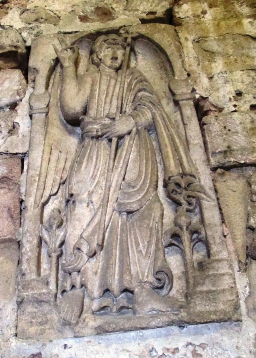 Priory Church of St Mary and St Hardulph it stands within the remnants of an Iron Age Hill Fort known as The Bulwarks and is the parish church of Breedon on the Hill village.
If lucky and the church is open, inside the church itself can be found one of the largest and most important collections of Anglo Saxon carved stone friezes in the country. One fine carving in particular is of the Archangel Michael named the Saxon Angel and is said to date from the 8th century. This is kept locked in the tower; fortunately there’s a copy in the nave. The carving is unusual in that the angel is shown giving the blessing with his thumb and third finger touching in the fashion of the eastern Byzantine Church. His clothing too is draped around him in the classical style. Where was it carved and where did it originate from ? Something that will probably never be known.
These days, unfortunately due to several attempted thefts and break-ins the church is usually kept locked.

After leaving the church walk back out onto the road, turn right and following the church wall pass through the gap between it and a pair of wide well made wooden gates. Under the stone wall to your left you’ll notice several raised sections, these supposedly built to allow views down into the quarry and out over it to the east towards Charnwood Forest. Unfortunately in places the undergrowth on the far side of the wall has grown up impeding the view.

Close to to the wall on the left stands the tall raised fire basket of the Queen Elisabeth Golden Jubilee Beacon, first lit for that occasion in June 2002. Subsequently followed in 2005 for the 200th anniversary of the death of Admiral Lord Nelson and again in June 2012 for the queens Diamond Jubilee. The last time it was lit was on May 2015 to commemorate the 70th anniversary of VE Day.
This beacon is part of a chain of beacons stretching right across country. The one to the north of this is set above Crich in Derbyshire; as the crow flies a good twenty/thirty miles away. With the one to the south standing proud, high up on Beacon hill on Charnwood forest and set at more or less 800 feet above sea level. If the night is bright and clear, when lit the blaze from both of these beacons can be clearly seen from where you’re standing here on the summit Breedon Hill.

Follow the wall around the church yard to where it starts to curve to the right. Leaving the wall walk straight ahead {south}, towards a wide metal walk through stile {Y’F’P’}. Here on the right stands an information board giving information about the hill’s 2,500 year old late Bronze Age early Iron Age hill fort.

Leaving the churchyard behind, jig through the stile to meander your way down a gravel path between hedges, by-passing a metal kissing gate with an information board standing close by. Here the scrubby hillside/sheep walk opens up on the right. Keep stumbling on down the steep hard track towards Breedon village, {south} until you see a wooden bench on the right. As the main gravel track curves to the left walk straight on between low thorns and ignoring a path leading off to the right continue steeply down to by-pass a {Y’F’P} and green information board before joining Hollow Road. Follow the road down for ten metres to join Squirrel Lane/Melbourne Lane, turn left and walking past the Hollybush Inn continue down to the village green.

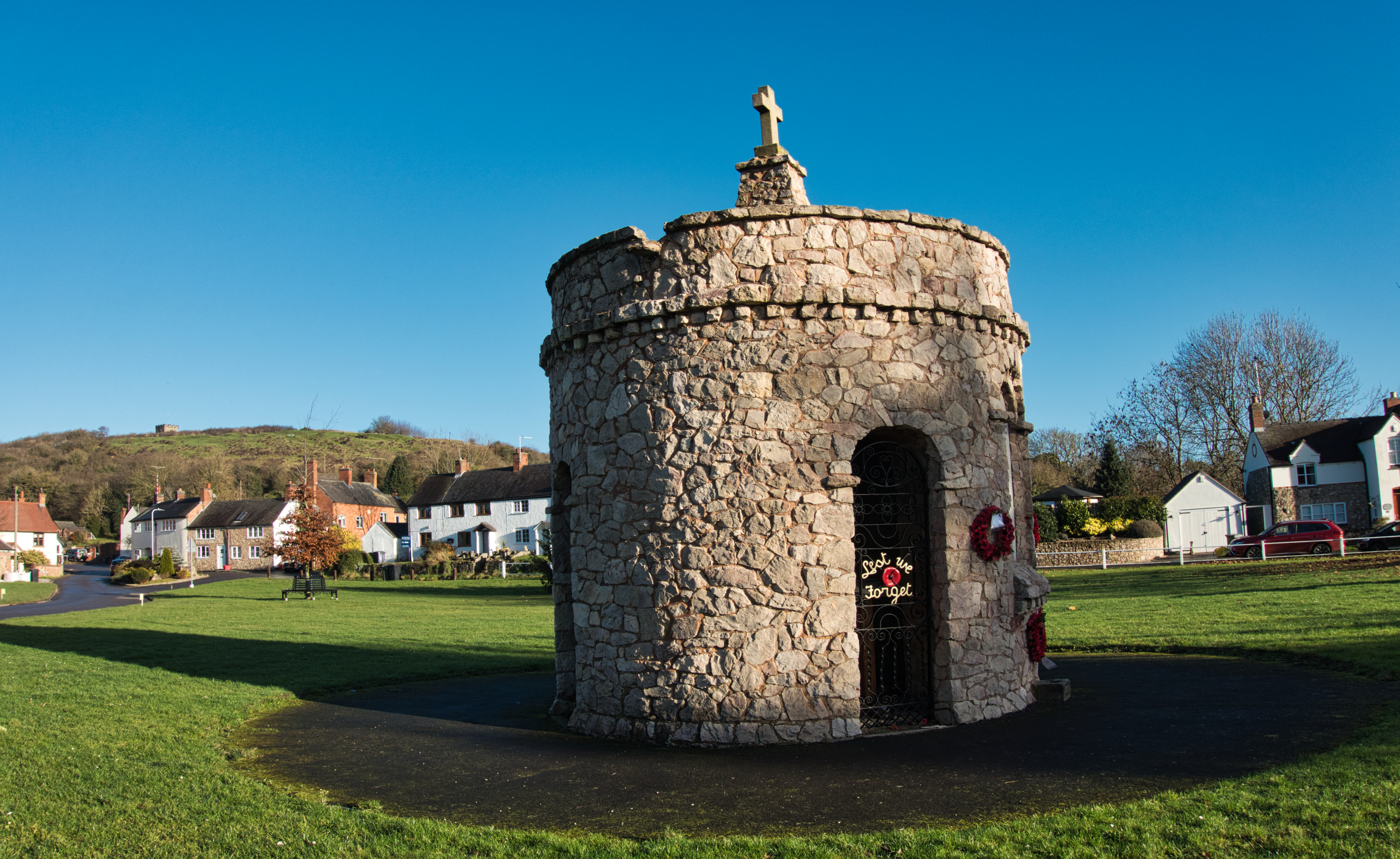
Walk around the right-hand side of the green by-passing the pink dolomite limestone dome of the village war memorial to join the A453 Ashby road.
Turn right, to walk past the entrance leading into a new housing development being built on the site of the former Priory Garden Centre. Continue along the pavement for a further 100 meters walking past the entrance to the Priory Golf Course. Fifteen metres beyond the entrance take a path on the right just before a low ivy covered stone wall, to cross over a short bridge above a small brook. Turn left, passing under a couple of large crack willows to follow a hard track between the alder lined brook and a post and rail fence/hedge belonging to the Priory Golf Course. Keep on for about 100 metres, until just after a bench on the left the ride bends round to the right, {R’F’M’} fastened to the corner of the fence.

Wander on along the ride between tall hedges, with glimpses of the golf coarse through it to the right. By-passing a {Y’F’P’} and wooden stile, continue following the track {west} to pass over a cross ride, {Y’F’P’}. Plod on past a mixed block of young deciduous trees and sticking to the hedge on your left you come out onto a wide fairway that offers more great views to the right and back towards Breedon Hill and its church.
Continue following the hedgerow {west}, to pass under a power line on the closely mown track, until you come to a gap in a hedge that leads off to the right, {Y’F’P’}. Pass through the break to continue on past another block of young trees leading out onto a second wide fairway. Keep plodding on enjoying more views of Breedon Hill until the hedge jigs off to the right; wooden bench in the corner. A grand spot to sit and enjoy the enchanting vista back down over the links to the south east.

From the bench follow the hedge rightwards, {Y’F’P’ hidden in the hedge on its apex}. Continue north west along the overgrown hedge as it follows the edge of a mixed woodland. Keep on, by-passing a {Y’F’P’} to pass between the hedge and another block of young trees until the wide muddy ride curves to the right, where after about five meters you reach the end of the track.

Bear left here taking a narrow path between a couple of wooden posts, to carefully skid down a steep slippery clay bank under tall hazel bushes into a deep dip. Climb up its far side and out onto the end of a narrow fairway {Y’F’P’}. Bear left here towards a {Y’F’P’} standing close to the hedge on the far side of the fairway. At the post turn left {south}, to once more pick up and follow the medieval park pale.

Lingering, meander your way alongside the line of the pale on an ancient and atmospheric woodland ride between a dense hedge camouflaging the low ridge of the pale and a superb scrum of aged deciduous woodland on your left.

Towards the end of the ride the woodland gradually develops into a younger plantation, plod on alongside this until after by-passing a large log placed across the end of track you leave the woodland to enter into a large arable field. {Y’F’P’} on the left standing under a large leaning crack willow

Keeping to the line of the park pale/hedge continue heading south for about 30 metres up to a {Y’F’P’}, bear sharp right following the hedge to a second {Y’F’P’}. Here over the hedge looking to the north, you get a great view out over the fields to where on the far horizon you can just make out the hills of the Derbyshire uplands north of the Trent valley. Turn left here following the headland towards a telecommunication tower, just beyond this stands a metal farm gate. Walk around its right hand side to step out onto
Burney Lane, {T’F’S}.

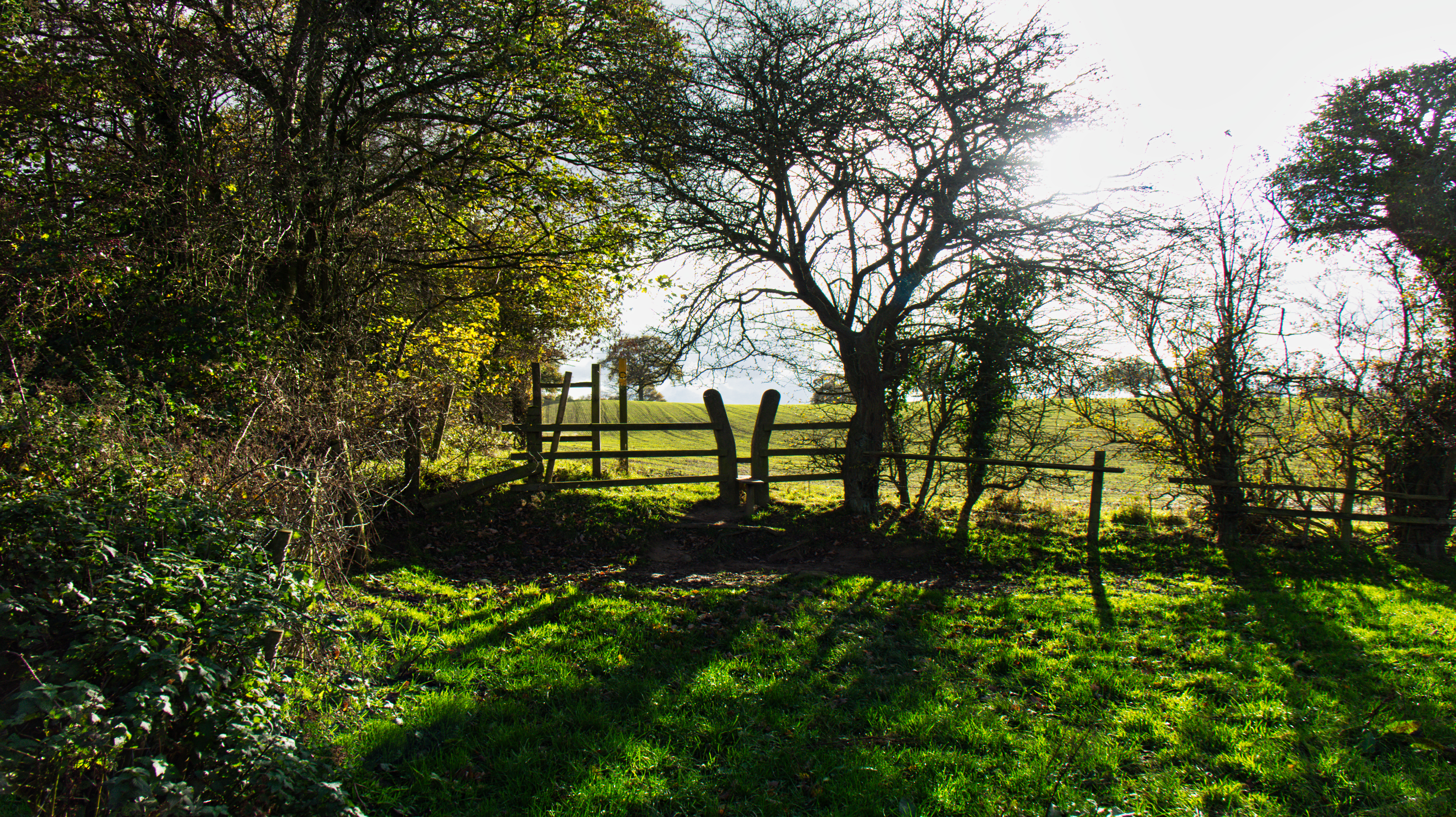
Tramp on down the Burney lane {south west}, for an eighth of a mile until you see a {T’F’S’} and two step wooden stile on the right, {R’F’M’}. Step over into a long narrow meadow to walk over the pasture, heading for a {Y’F’P} and x two step stile set in the post and rail fence opposite.

Awkwardly clamber over the stile to drop down into the next pasture. Descend steeply down towards a dense oak tree lined hedge. Bear right following the hedge into the northern left-hand corner of this lush green meadow to find a metal farm gate with a wooden stile to its left, {R’F’M’}.

Step over into the next meadow and immediately turn left. Follow the hedge down towards a {Y’F’P’}, after five meters turn left again to follow the hedge towards a carved oak squeeze stile.
Squeeze through into a freshly sown grass field {Y’F’P’}, turn right following the hedge down to the fields right-hand corner. Turn left and follow the tall densely overgrown hedge above a thickly alder lined brook until the hedge curves to the right, where hidden amongst the thorns and hazel, on the right you will find another carved squeeze stile and {Y’F’P’}.

Pass through the squeeze, dropping steeply down into a wooded valley to cross over a stout wooden bridge leading over the Scotland Farm Brook. This is the brook that works its way north through Paddock Pool and Quarry woods before eventually feeding into Melbourne Pool. Climb up the far side through a pleasant tangle of hazel coppice to a wooden kissing gate on the western edge
of the thicket.

Take the wicket and entering a damp triangular shaped meadow, stick to the left-hand hedge-line as it curves gently away to the left; squelch your way up into its far left corner. Where, set just to the left of a dead twelve foot high ivy covered ash stump you’ll find a carved wooden squeeze stile, {Y’F’P’}. Plug your way through a couple or three metres of boot sucking mud to slip through the stile, before climbing up a few short Steps and out on to the
B 587 Lount to Melbourne Road.

Carefully cross the road in a slight diagonal direction leftwards, passing under tall roadside sycamores and field maple before dropping down the bank to pass through a carved oak squeeze’. Walk over a narrow strip of grassland to a second squeeze’ set in the wire sheep fencing on the edge of Spring Wood, {Y’F’P’}.
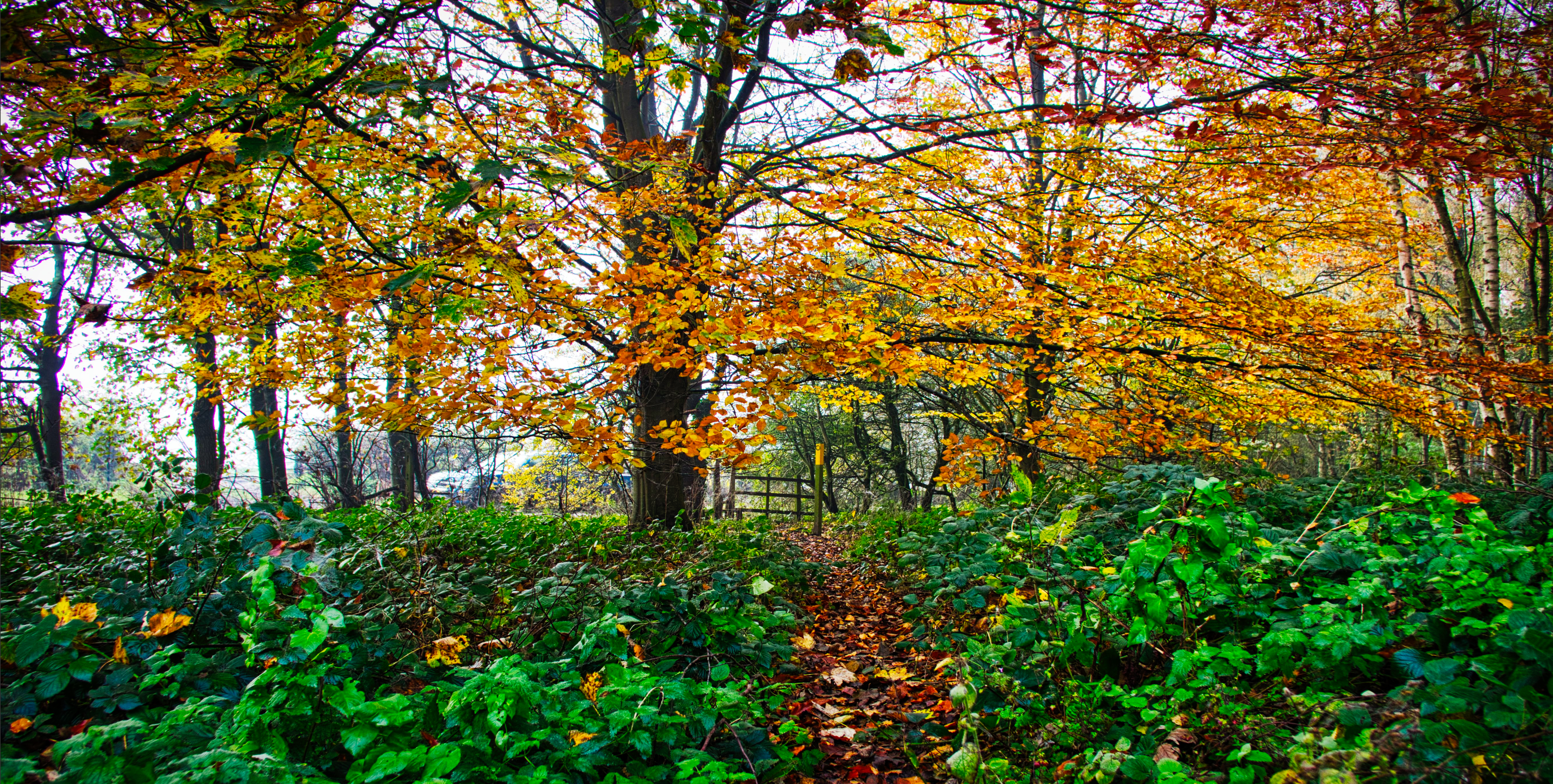
The next few hundred meters as you wander along the woodland rides and tracks under the aged birches rowans and oaks of Spring Wood is a sensual arboreal pleasure and is just superb. Particularly so in the spring when the bracken has fallen and the blue bells are in full bloom, making your walk through them a rare and
scented privilege.

Enter the forest turning left at a {Y’F’P’}. Follow the ride/track under birches and rowans alongside the edge of the wood. Keep wandering along the bracken lined trail, until after passing under a section of tall stemmed larch beeches and oaks, set just to the right of a giant double stemmed oak, squeeze through a carved wooden stile set to the left of a wooden shut gate, {Y’F’P’}.

Stroll on through the woodland under a mix’ of larch and oaks, by-passing a couple of low wooden benches thoughtfully placed in a shady clearing beneath the drooping branches of a grand old beech.

Keep wending your way along the ride through low brambles, while passing beneath a shadowed glade of silver birch sycamores and a scattering of the odd lone oak tree, to pass through the gap left by a fallen shut gate, {redundant squeeze stile to its right}. Plod on for about fifteen metres to meet a wide cross ride, {Y’F’P’}.

Turn left following the broad hard ride until in the brambles on the left you see a {Y’F’P’}. Turn hard right here, leaving the ride to follow a narrow path through low brambles passing under a bushy multi stemmed oak standing just to the left of the path. Keep brushing through the brambles for about 100 metres, until after passing beneath a couple of beeches, {Y’F’P’} you step through or pass/by a final carved oak wooden stile to walk out onto the Calke Road.
Turning right, {west} and keeping an eye open for speeding cars wander down the tree lined road as it gently curves to the left beneath a high wooded bank and the beautiful mixed oak woodland of Spring Wood.

This part of Spring Wood is on the Derbyshire Leicestershire border and is a Wildlife Trust Nature Reserve, renown locally for its wonderful show of spring bluebells.

Before too long on the left you by/pass the Severn Trent, Staunton Reservoir car park. Here the road starts to curve down to the right before bringing you to a bridge passing over the southern narrows of the reservoir. From here, leaning on the wall of the bridge looking to the north, if clear you can get some superb views down its whole length towards the Melbourne end.

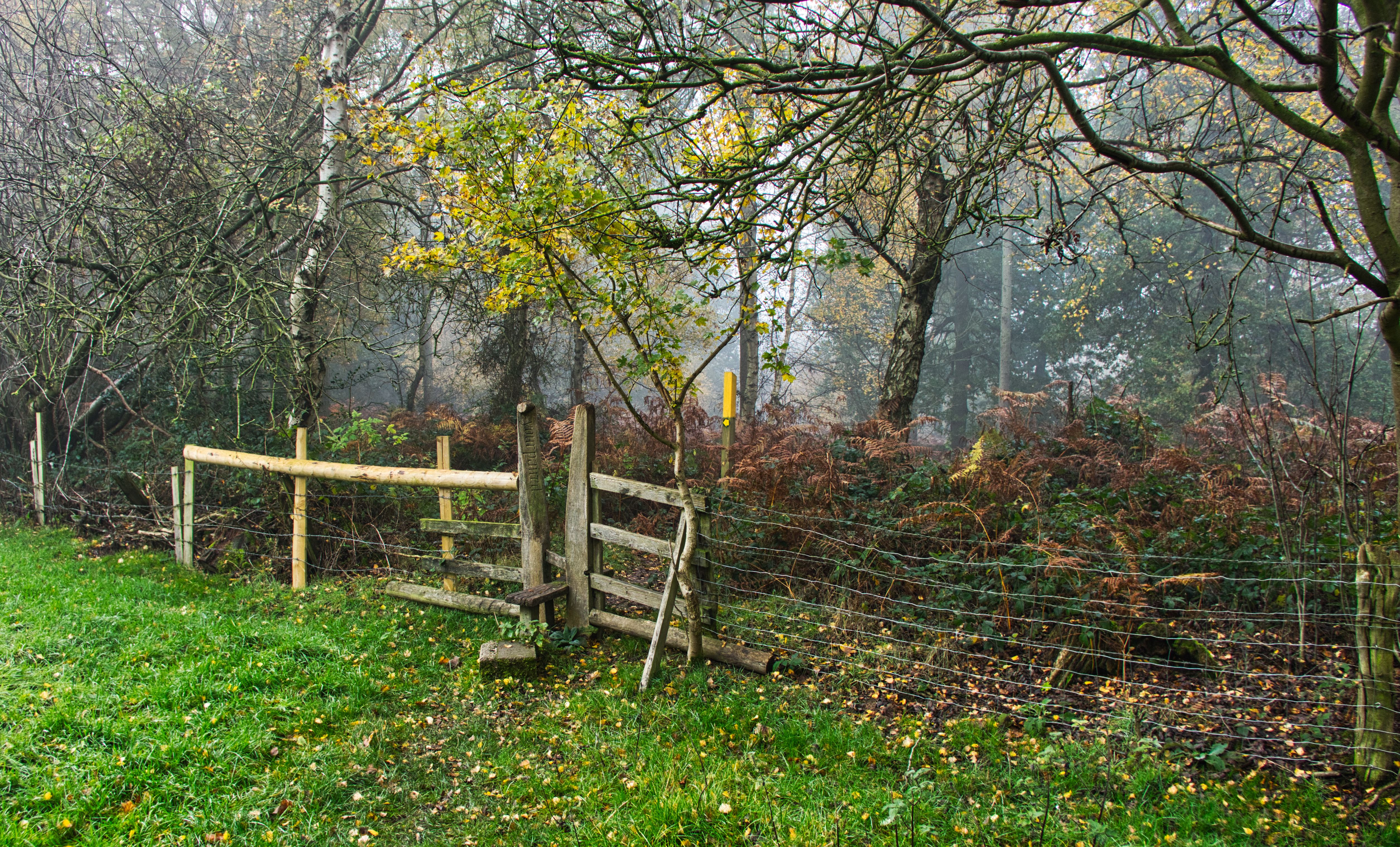
Leaving the bridge, continue plodding up the road towards Calke. {West. Safest on the left-hand side of the road}. After about 80 meters, on the left you will see the entrance into the Dimminsdale Nature Reserve, { known locally as The Lead Mines}. Pass between rails to squeeze through a wooden stile, {information board to its right}, follow the hard gravel path as it twists and turns through a wild scrum of thorns and elder before passing over a short wooden bridge, this shortly followed by a board walk. Descend a set of wooden steps to an information board before steeply descending a second set of steps above and between a couple of ancient lime slaking pits to drop down to a {Y’F’P’, R’F’Ms}. Turn right here.

Before you do this and you have the time, Its worth your while to turn left and walk the sixty meters or so passing over a couple of wooden bridges above a small stream, {the Red Brook} to pay a visit to the bottomless ! and deeply atmospheric pool called
the Laundry Pond.

Retrace your steps back over the bridges to continue along the ride under a thin canopy of tall thin ivy covered alders and ash while listening to the babbling of the red brook to your left and by/passing a dark brackish densely tree lined pit/pond to the right of the trail, {plain wooden post displaying a number nine}.

Soon the the thicket on the right starts to give way to a grass meadow. Walk on for about thirty metres to drop steeply down a set of steps on the left to once more meet up with the red brook. Turn right just before the stream to pass through a wooden squeeze stile standing under a great ash set just left of the trail. Continue following the hard ride as it slowly twists and turns under the dappled shade of tall lanky ash and alders until eventually the woodland gradually narrows off. Keep on under a line of great old ash trees overhanging the track on the right, until after a final ancient arch of ash you come to a wooden squeeze stile, {R’F’M’}. Walk out onto Heath Lane.

Cross straight over the lane to a wooden squeeze’ on the edge of a mixed broad leaf woodland; Heathend Plantation {R’F’M’}. Enter the wood and turn right, follow the ride for about five metres until on reaching a plain wooden finger post {R’F’M}, the track veers to the left. Wander on up through a well thought out young plantation of native trees, with the ride gradually curving its way through the young oaks ash and cherry trees, until after a final curve to the left you pick up a post and rail fence. Follow the fence to reach a sharp turn to the right from where after a couple of metres or so you leave the woodland. Push on up the hard limestone track between the hedge on the left and a wire stock fence passing under a large
hedgerow oak.

Stump on up hill until after by-passing a dead stag horned oak tree the track veers sharply to the left, {plain wooden finger post with R’F’M}. Stick with the ride until after passing under a large old ash you pass through a couple of wooden wicket gates.
{Nice old red brick byre to the left of the track}.

After passing the end of the hovel, the fields on the left give way to a young oak and beech planting. Follow alongside the saplings until the ride veers to the left, here on the right you start to pick up a short section of the old stone wall that encloses the parkland of Calke Abbey. At the end of the wall, pass through a wooden wicket gate to enter the deer park.

Ignoring the track leading straight ahead {north}, bear right {north east}, to follow a hard grass track through a group of gnarled old parkland oaks. Tramp on through the park while getting views above the hill to your right of the estate church of St Giles.

Shortly you arrive at a cross ride, {wooden finger post with R’F’M’}, turn right here and head towards the church, {east}. Push on steeply up hill towards a large clump of beeches hiding the remains of the old estate deer shelter, {information board adjacent to the shelter}.

After leaving the shelter continue walking towards the church. Here a wonderful view opens up down into the valley to the left, where hiding behind a giant monkey puzzle tree you begin glimpse the frontal facade of Calke Abbey.

Wander on down the hill to join the metaled southern approach to the hall. Turn left along the drive and following the Ha-ha, by-pass on your left the gnarled twisted trunks of a pair of impressive 300/400 hundred year old sweet chestnut trees. Until at a point where the Ha-ha dips you come to the wrought iron fencing and gates of the halls southern gateway, allowing you a splendid view through to the impressive classical extravaganza of the of
the Abbey.

Calke had been home to the Harpur Crew family since 1622. Though the baroque mansion/hall itself was not built until 1701-1704, this on the site of a 12th century Augustinian monastery; hence the name of Calke Abbey. The Harpur family had lived in it for nearly 300 years until in 1985 the hall and all of its estates passed to the National Trust in leu of death duties.
Since then the house and its gardens have been kept more or less in the same condition that they were found when the trust took them over and are a rare portrayal of the decline of the English country house over the centuries.
Both the hall, gardens and deer park are well worth spending a day exploring in there own right.

Continue walking up the drive as it curves right-wards towards the fine red brick stable buildings of the hall and to where a drive comes in diagonally from the left; here on your right you’ll see a white rail fence with a white wooden five/bar gate.
This gate leads to the entrance arch of the massive quadrangle of what were the estate stable buildings. Like the hall these too are kept in their original condition and well worth the short
detour to explore.
Walk on past the white gate to continue on down the left-hand side of the stable buildings, after passing through a wicket gate to the left of a wooden five/bar gate, carry on following a wide gravel track past the National Trust café and outside seating area, {toilets here}. Pass through a break in a stone wall just left of a red brick building and out into the visitor car park.
{Mobile N’T’ information trailer and a Calke Park Info’
Board on the left}.
Forge straight ahead over the carpark, passing through a wide gap in a stone wall into a second larger parking area. Cross it in a diagonal direction aiming for its far left-hand corner, where to the left of a picnic table on the edge of the parking you’ll find a gravel path leading steeply down to a wooden wicket gate.

Continue following the path above a deep densely wooded valley {west}, for about twenty metres before taking a track on the right leading back down diagonally eastwards. Tramp on as it falls steeply down spaced steps to a narrow lake in the valley bottom. Pass through a wicket gate {N’F’W’M’}, to follow the hard gravel path just above the weir of Thatch House Pond as it falls noisily into the Mere Pond. Keep wandering on past a couple of large ancient and delightfully contorted beech to by-pass a path leading down from the right {Y’F’P’}.

Continue following the parkland deer fence until you come to the end of the Mere Pond. Sticking to the fence grind steeply up through the ancient oaks of Serpentine Wood, by-passing a wooden
finger post {N’F’W’M’}.

This part of Calke park, {the Serpentine Wood and the Rookery Wood} are a National Nature Reserve and contain some of the oldest oak trees in western Europe. One named The Old Man of Calke is estimated to be at least a thousand years old.
As you make your way up the wide ride, on the right looking through the deer fence you will see some of these ancient oaks, many of them stag headed and many well over 500 years old.
Here too, on the right you can often see the park’s herd of Fallow Deer browsing and resting under the great boughs of these
venerable and ancient veterans.

Continue up the broad bracken lined ride until you come to a wooden finger post, {R’F’M’s} and information board at the junction of a cross track close to the edge of the woodland. Turn left here and follow the hard gravel trail for 30 metres to find in the low stone wall on the right a wooden wicket, {R’F’M’}.

Leaving Calke Park behind pass through the gate into a grass meadow, turn left and after a few metres squeeze through a wooden squeeze stile into the following meadow. Plod straight over the field in a diagonal direction on an obvious earthen track {northwards}, aiming for a wooden squeeze’ set in the centre of the hedge-line, more or less 80 metres to the right of the clump of trees hiding
White Leys Farm.

Looking to the northeast, as you walk across the meadows you get great views over the trees and fields towards Staunton Reservoir and all the way down to the dam at its northern end. Whilst over to the east the square tower of the Parish Church of St Mary and St Hardulph stands out on the top of Breedon Hill. 
Step through the squeeze stile to cross straight over a broad farm track leading up towards White Lea Farm before pushing on through a second squeeze’ into a beet field, {R’F’M’}. Continue following the well worn earthen track through the beets towards the thicket of trees just right of White Leys Farm. Follow the wide track as it curves to the right under a line of young oaks, before curving back to the left to follow a low drystone wall overhung with scrub trees and thorns leading down to an old forked ash tree.

At the ash tree turn right off the track to follow a well trodden path down through the beets {north}, towards the alder lined valley bottom. Pass over a wooden bridge between rails above a small clear stream named the Scots Brook, {R’F’M’s. This is the brook that eventually feeds into the western arm of the reservoir.

Leaving the alder lined brook behind, step through into a wide steep grass meadow and following the obvious worn path leading steeply up the hillside, head towards a large dead ash tree standing in its top right-hand corner. Step over a two step wooden stile to the left of a metal farm gate and out onto Broadstone Lane,
{tall wooden footpath sign}.
Ignoring the footpath opposite, turn right to wander down the lane between hedges as it gradually curves to the right, until after passing a small thicket of young saplings, in the gateway on the left you see a pair of wide wooden five/bar gates with a wicket’ to their left. Push through, or step round the gate on its left onto a wide metaled track {Severn Trent information board to its right.
Here you are entering the property of Severn Trent Water Board.

Turn immediately right just past the information board to head down towards the narrow western arm of Staunton Reservoir. Bearing left, keep following a vague grass path to pass under an electricity line. Continue east alongside a thick tangle of brambles; where the briars end drop down to the reservoir proper.

Drift on just above the water-line.
{At this point if the water is low its possible to drop down to the sandy shore of the reservoir and walk along that if you prefer}. On reaching a small thicket of birches and oaks the path bears up to the left. Follow it up alongside the copse for a few meters, until on the right leading through the oaks you will find a small bare earthen path. Take this stumbling first down then up again before leaving the thicket and once more pick up the path around the reservoir.

Keep contouring above the water-line to pass through the right-hand end of a second oak copse. Stick to the path as the reservoir widens and the dam wall at its northern end comes into sight. From here looking south east over the reservoir, standing high above its eastern shore you can see the oak woodlands of Spring Wood and the nature reserve that you walked through earlier before dropping down to the Lead Mines.

Walk on between a young oak and an ash sapling to pass over a small muddy ditch before heading towards a post/rail fence and the tall trees that surround the Staunton Harold Sailing Club buildings and it’s clubhouse. Bear left here and following the club’s boundary fence walk up to join a metaled drive.

Turn right following the drive past the clubhouse, until you come to a tall footpath sign pointing down into a small copse to the right. Follow the path down under tall overgrown hazels, by-passing an open picnic area with wooden benches and tables before dropping back down to the reservoir. Plod on through trees and Hazels, until after by-passing a small sandy beach the track bears to the right through the copse. Cross over a wooden bridge above a small muddy ditch to gently climb up to a post and rail fence on the edge of the thicket. Walk out into the reservoirs visitor carpark.

Walk straight on by-passing a children’s play area, and sticking to a low stone wall bear leftwards to the reservoirs café/information point. From here on top of the small hill straight ahead you’ll see the red brick stump of an old windmill. Head towards this crossing over the approach road to the carpark to continue trudging up a steep gravel path to its base.

This tower windmill was built by the First Lord Melbourne in 1798 at a cost of £250,00 and what must have been a snip at the price ! The mill was disused by the late 19th century and became derelict. In 1963 the water board decided to renovate it and create an observation point overlooking the reservoir, unfortunately the work was never completed as the tower was deemed to be unsafe.

Leaving the mill behind follow the gravel path down through the short cropped grassland {eastwards}, as it curves to the right and left through spaced standard trees. Exit Severn Trent property through a wooden wicket gate set in a post and rail fence to the left of the reservoir’s five bar entrance gates and meander on down the drive, by-passing on your right the stone wall entrance to the maintenance track that passes under the dam wall.

Continue down the drive following a sandstone wall. {This last section of the drive is a remnant of the old Calke road; flooded when the reservoir was built}. Keep plodding down Calke Road to its junction with Melbourne Road. Turn left and follow the pavement towards the village, crossing over the junction of Robinsons Road that leads off to the left towards Ticknal. Walk on past the junction for about 100 meters or so until on the right-hand side of the road you see a bus stop sign and {T’F’S}.

Obeying the sign, pass through a broken down wicket gate into a wide deep meadow. Take the path as it curves steeply down leftwards aiming for the end of a stone wall overhung with tall beeches and trees.

Following the wall pass under a holly to push through a gap in the hedge in the corner of the pasture. Continue following the hedge as the path snakes its way along the brow of the hill, before leading up towards a clump of tall trees. Here join a hard gravel path arriving diagonally up out of the valley.
Follow the gravel/concrete path up to the left passing between the clump of tall trees and the hedge, until shortly after walking under a large lone Austrian Pine you leave the clump behind and the path starts to curve towards the right-hand hedge line. Plug on through a wide muddy ginnel between a tall beech hedge and the rough bramble covered hedge on the right, to find a wooden kissing gate leading out onto Pen Lane {T’F’S’}.
Turn right and follow the footpath along Pen Lane, by-passing a mix’ of lovely sandstone and old red brick town houses, until after about 150 metres on the right you come to a tall red brick
Victorian building.
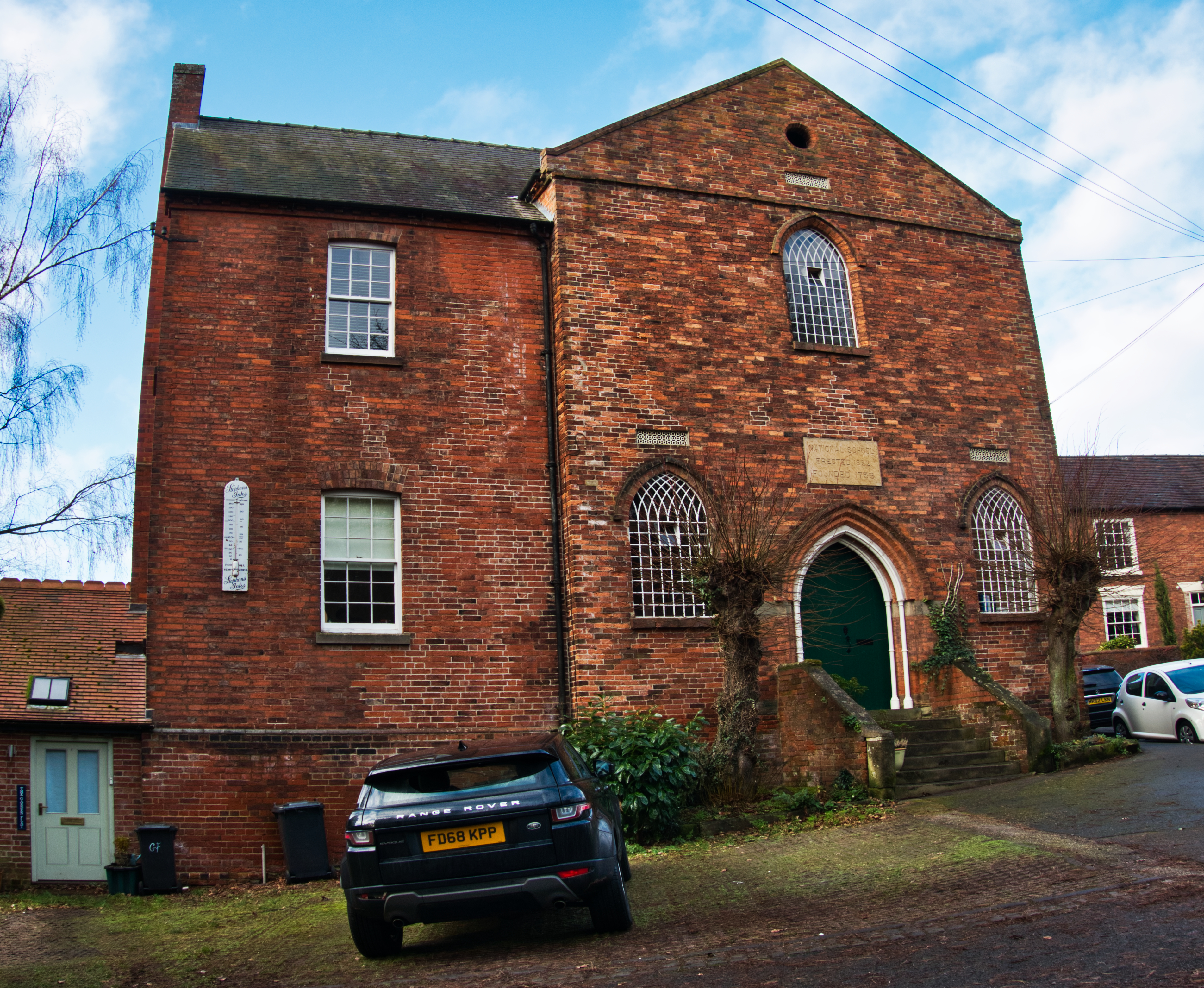
 The old school house, with its typical 19th century Victorian gothic style chapel windows was built in 1822 and was part of the English National School System. An organisation founded in 1738 to provide some elementary education to poor children and to promote the teachings of the Christion religion as taught at that time by the Church of England. Converted recently into a block of residential flats.
Shortly after the leaving the school-house, at a road sign the lane bends sharply to the left, {Salisbury Lane}. Ignoring Salisbury Lane, plod straight on down the continuation of Pen Lane {now one way}, passing between tall sandstone walls overhung with hedges and tall trees as the lane gradually curves first to the left then
back to the right.

Eventually the road curves sharply back to the left, where facing you on the bend is a red brick house named Vale House {no 100}. Here, leading off to the right, between the end of the stone wall and the house you will find a narrow twitchel. Take the jitty past the terraced cottage of {no 100a}, to pass through a red brick arch taking you beneath its upper storey.
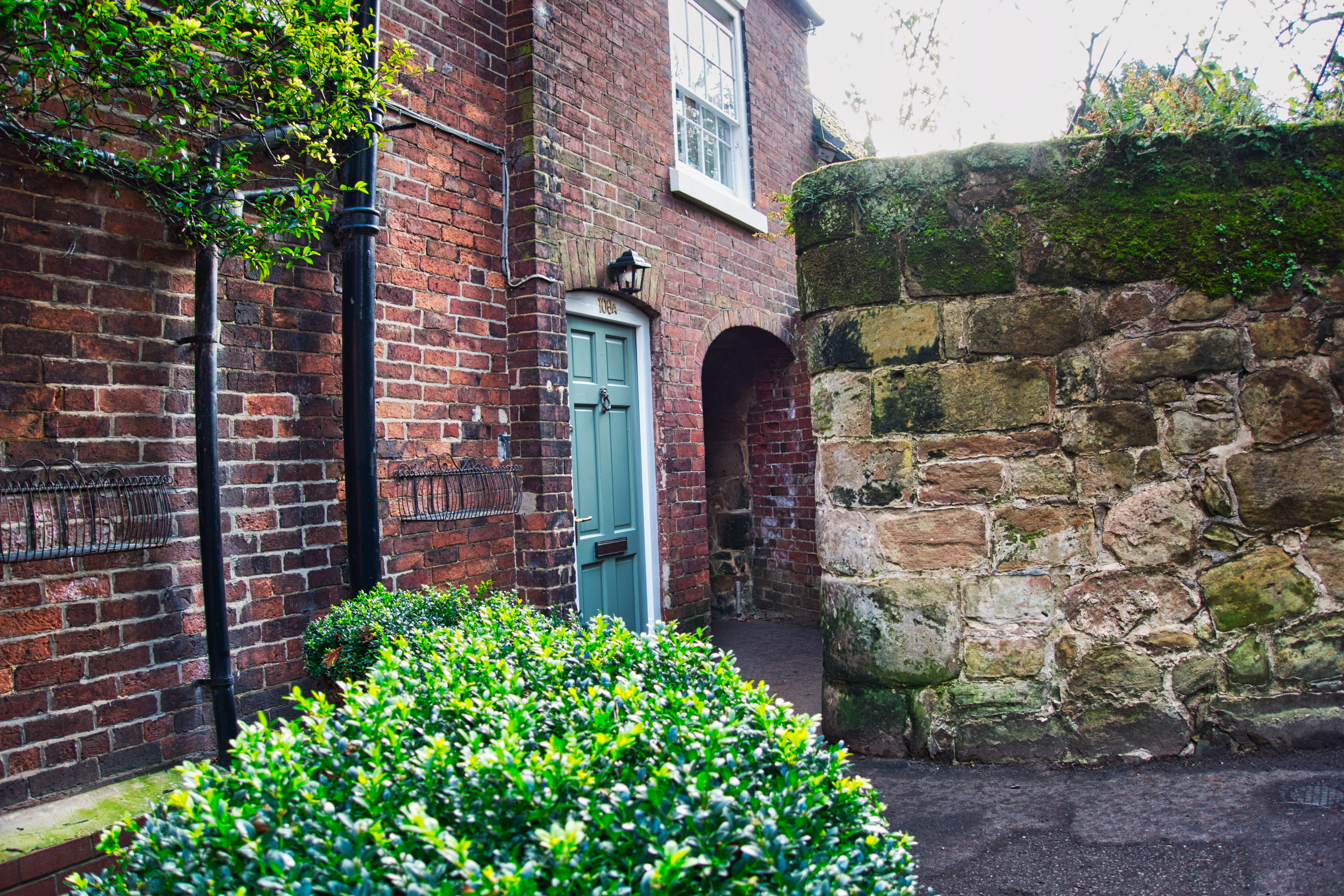
The words Twitchel and Jitty are both colloquial east midland words to describe a narrow passage.

Continue between moss covered sandstone walls, to pass under a giant sycamore tree before coming out by the fine Norman west door of St Michael and St Marys Church. Wander on, passing the church on its northern side to arrive back at your car and bringing you to the end of another grand
North Midland Jaunt.


Great walk! Great photos!
LikeLike
Thanks Josie.
LikeLike